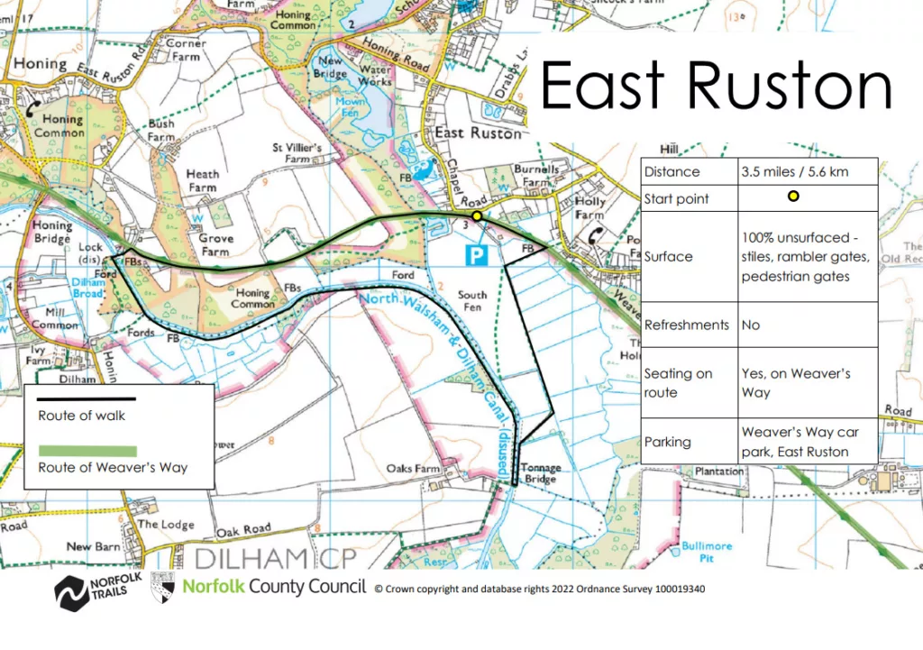
Norfolk is not normally considered the first choice when considering industrial archaeology, but you would be wrong. This walk takes you to some stunning natural wetland landscapes, but there is also wealth of Industrial archaeology hidden in plain sight. To the north of Wayford Bridge the old course of the River Ant has been straightened and canalised in part, forming a section of the North Walsham and Dilham Canal, Norfolk’s only true canal. The canal which opened in 1826, was nearly 9 miles long, and extended as far as Antingham Bone Mills. The Norfolk wherries used to ply their trade along the canal, sadly no longer, but these historic boats with sails hoisted can still be seen elsewhere in the broads if you are lucky.
The canal had six locks with Lock No 1 at Honing, now the furthest extent of water access for canoes and small craft. The main function of the canal was to improve the navigation for the wherry trade which served the farms and a series of watermills connected to the River Ant from Dilham northwards.
As well as Honing lock, walkers can also cross this southern section of the canal at historic Tonnage Bridge. The bridge partly collapsed in 1980 but has been rebuilt.
The canal suffered commercially following the building of the Great Yarmouth to North Walsham railway. Early schemes to encourage leisure use were unsuccessful. By 1923 traffic had reduced to six wherries and by the early 1930s there was only one, the ELLA, which last used the canal in 1934. The disused route of the railway crosses this area and now forms part of the long-distance Weavers’ Way footpath. The line of the route has now naturalised to the extent that it is hard to imagine it as a railway line, however a crossing keeper’s cottage and other traces of railway archaeology offer clues to its former use.
